Amador Fire Safe Council
+
Amador Resource Conservation District
Jido Geospatial's approach to this GIS consulting project followed a structured, multi-phase process. We began with a GIS Data Evaluation, assessing current data usage, user needs, and platform capabilities. Next, a Platform Evaluation examined infrastructure, data storage, and emerging technologies to recommend the best GIS solution. The Implementation and Data Migration phase involved software procurement, role assignments, and seamless data transfer to a centralized repository. As part of this process, we successfully migrated GIS data to ArcGIS Online, ensuring efficient cloud integration and accessibility. We then established Mapping Protocols, setting design standards and templates for consistency. A Training and Documentation phase provided resources tailored to both technical and non-technical users. Lastly, we developed ArcGIS Hub, Apps, and Automations, creating interactive maps, dashboards, and backup solutions to enhance long-term GIS functionality.
-
![]()
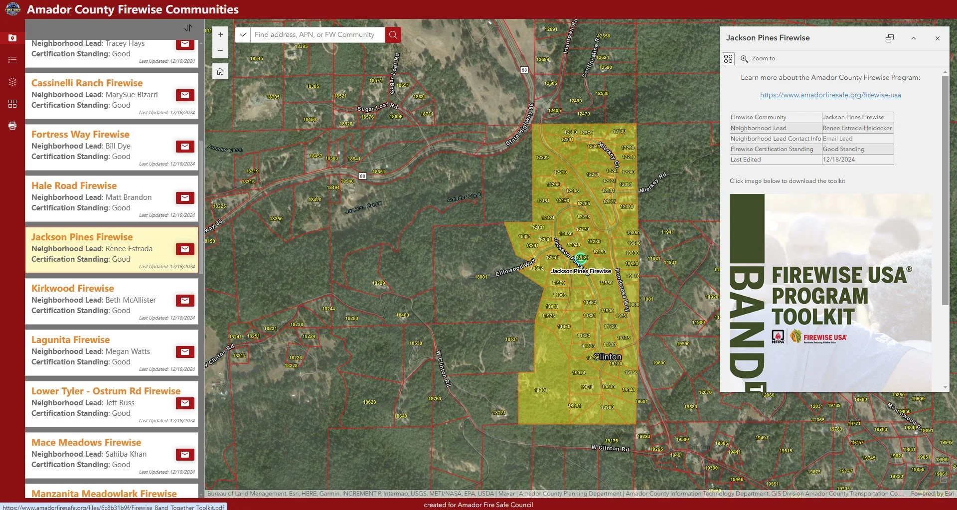
Amador County Firewise Communities Web App
-
![]()
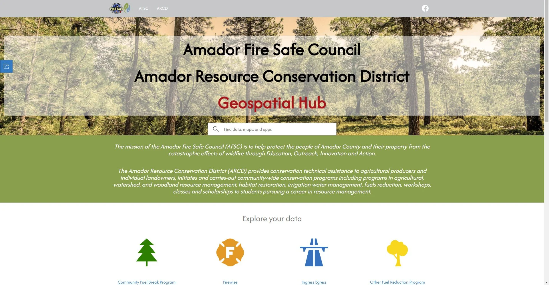
ArcGIS Hub