City of San Marcos, CA

At the City of San Marcos, CA, I was responsible for building their GIS program from the ground up. Over eight-plus years, I developed the Enterprise GIS and provided support to all City departments. My work included trail mapping, emergency operations support, fire mapping, General Plan update mapping, GPS project management, digitizing assets from Engineering As-Builts, citizen notifications, label creation, training, and coding. During my tenure, I received multiple GIS-related awards, spoke at conferences and colleges, and authored several papers.
-
![]()
Public Works - Project Area
Project Area map for the Public Works Department.
-
![]()
Public Works - Street Sweeping
Street Sweeping Schedule map for the Public Works Department.
-
![]()
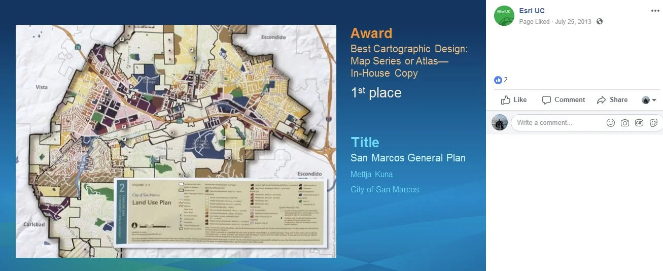
Planning - General Plan Update Map Series
Created a series of maps for the City’s General Plan update for which I won a Map Gallery award at the Esri User’s Conference for Best Overall and First Place for Best Cartographic Design: Map Series or Atlas - In-House Copy. All maps can be viewed on the City’s website here.
-
![]()
Planning - General Plan Update Map Series 1
Created a series of maps for the City’s General Plan update for which I won a Map Gallery award at the Esri User’s Conference for Best Overall and First Place for Best Cartographic Design: Map Series or Atlas - In-House Copy. All maps can be viewed on the City’s website here.
-
![]()
Planning - General Plan Update Map Series 2
Created a series of maps for the City’s General Plan update for which I won a Map Gallery award at the Esri User’s Conference for Best Overall and First Place for Best Cartographic Design: Map Series or Atlas - In-House Copy. All maps can be viewed on the City’s website here.re
-
![]()
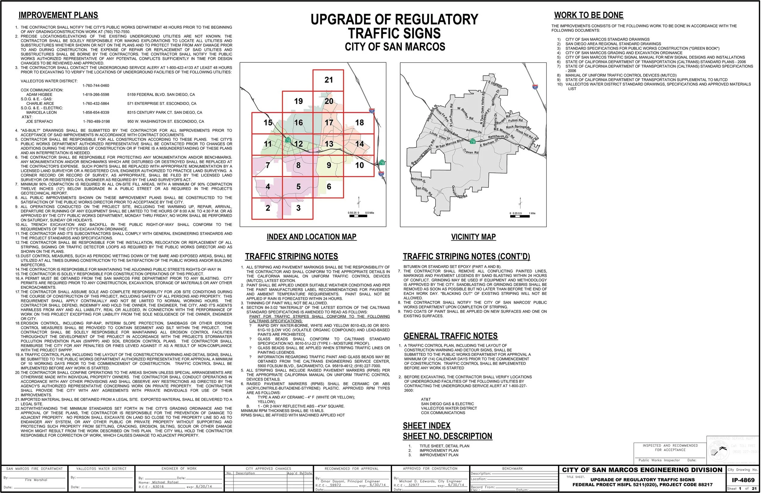
Engineering - Sign Replacement GPS & Map Series
Regulatory Traffic Signs were GPS’d using Trimble GPS and a map series was created.
-
![]()
Finance - Tax Districts
Map displaying all tax districts within San Marcos.
-
![]()
Planning - Zoning Map Series
Collaborated closely with Planning Staff to develop the zoning layer through an iterative process. Once finalized, I created a map series.
-
![]()
Affordable Housing - Trail Accessibility
Map displaying affordable housing locations along with City trail network.
-
![]()
Parks and Recreation - Trails Pocket Guide
Double-sided trail pocket guides were created for both the north and south portions of the city. One side had the trail map, the other side had information about the trailheads and sites long the trail. An additional citywide trail brochure was created. These maps were printed and distributed at various kiosks throughout the city.
-
![]()
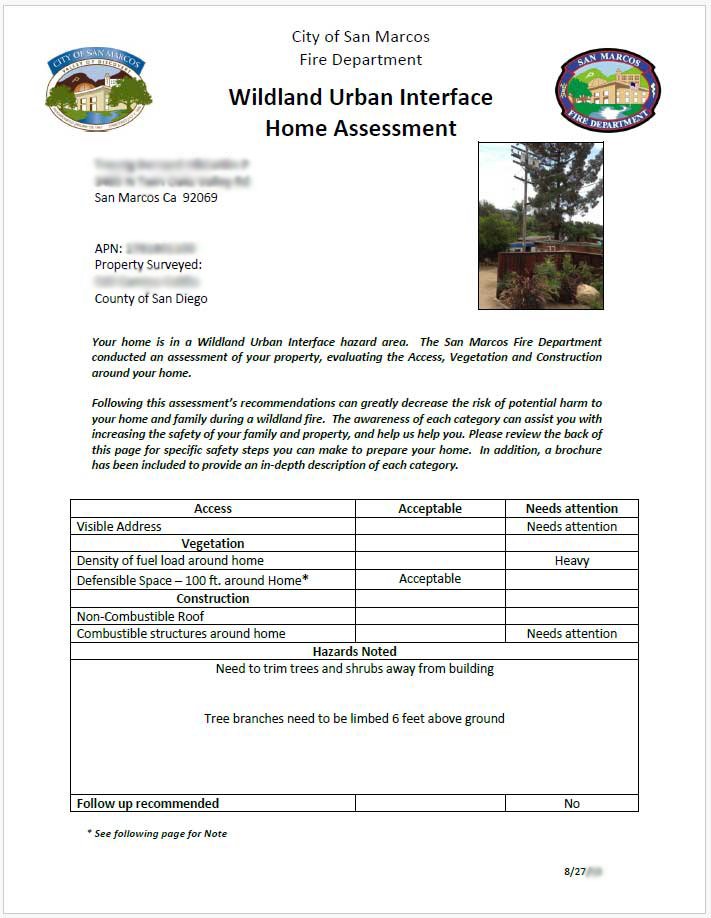
Fire - GPS Field Assessment + MS Word Integration
Fire Staff used Trimble GPS to assess homes along the wildland urban interface. Photos were taken at each home and an easy-to-use GPS form was created. Once finalized, the GPS points were merged with parcel information to obtain owner information. The data was then integrated with MS Word to create letters and mailing labels.
-
![]()
Engineering - ADA GPS Field Assessment
Engineering staff used a Trimble GPS to identify potential ADA hazards. This data was then imported into Crystal Reports to generate a report.
-
![]()
Engineering - Stormwater + Data Model + Asset Management + Permitting + Inventory
The first phase of this project involved creating a stormwater data model. The second phase involved digitizing the City’s storm utility network using Engineering As-built plans. Once digitized, stormwater BMPs were GPS’d and map series were developed during the third phase. 3rd-party integrations with work order, asset management, and permitting systems occurred during the final phase.
-
![]()
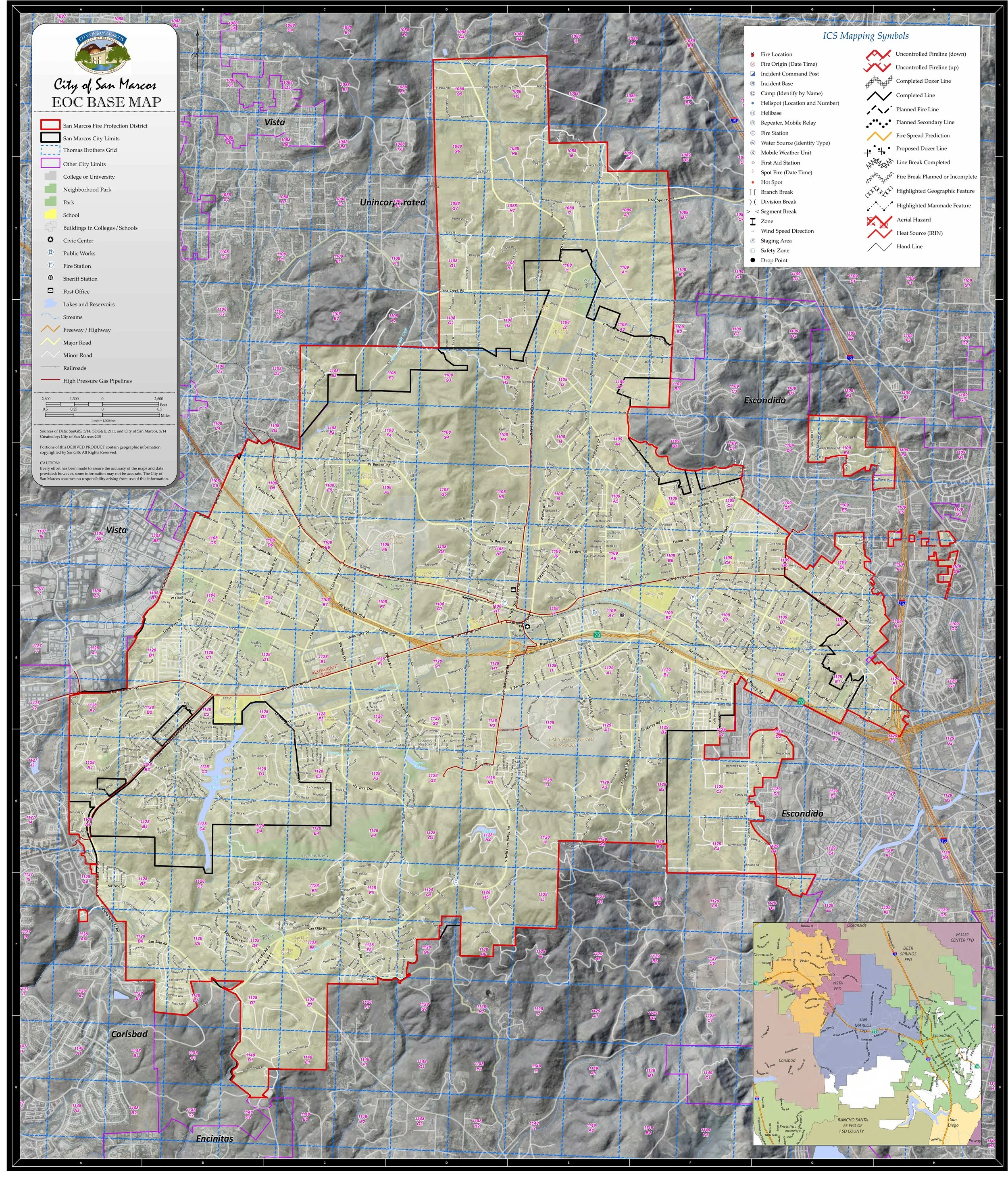
EOC - Planning + Preparation + Activation
Planned, prepared, and participated in EOC activation during the Cocos Fire. Provided GIS support to emergency staff, County EOC, citizens, and media. Created EOC activation protocol for GIS services.
-
![]()
Planning - Owner Notification Map + Mailing Labels
Prepared hundreds of notification maps and labels, including Modelbuilder workflow for efficient creation of owner and occupant notifications.
-
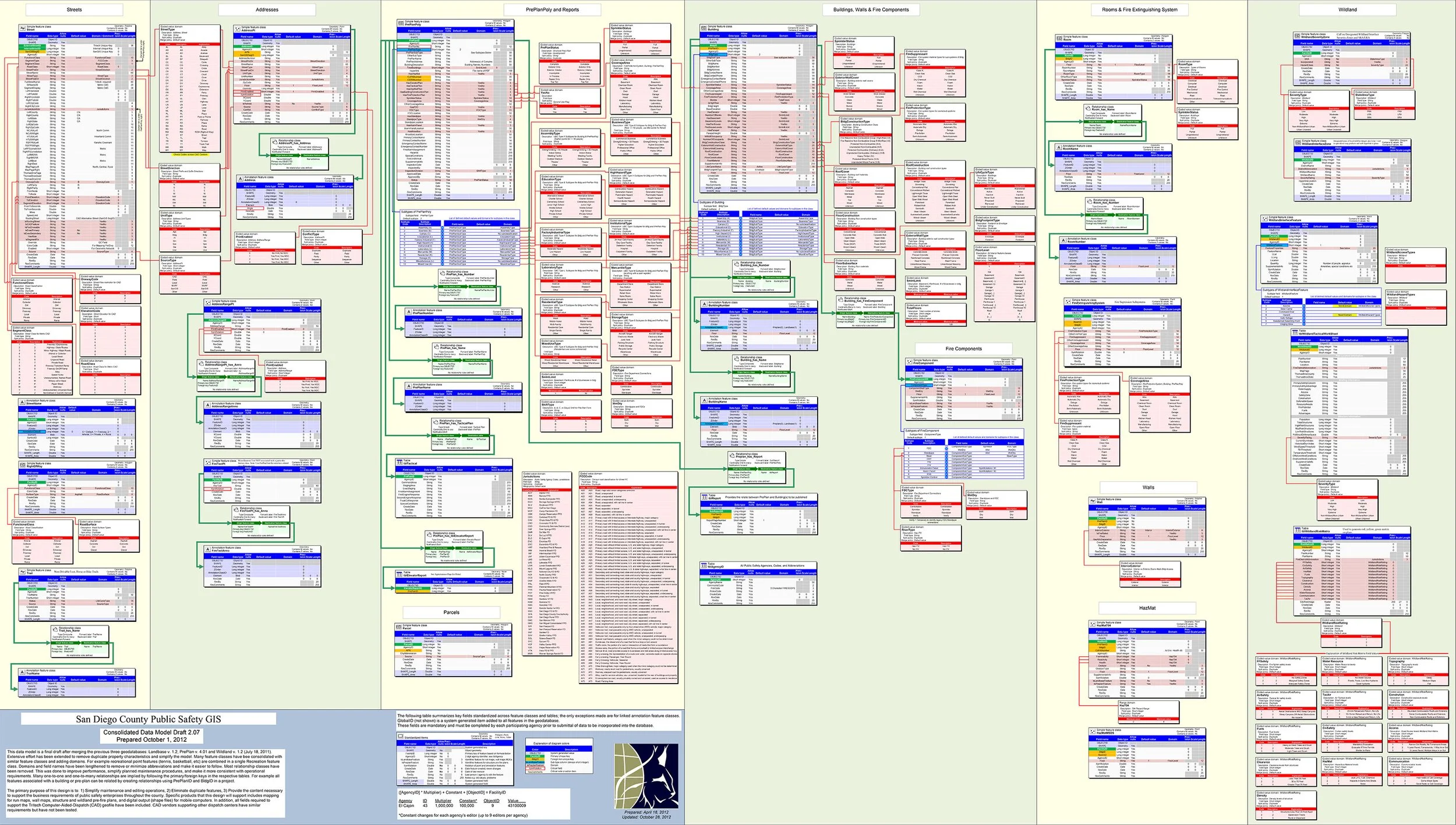
![]()
Fire - Regional Emergency Data Model Contribution
Active participation in cross-jurisdictional fire response data model creation. Implemented data model at the City for fire run books and emergency tablets, and provided input on regional data model.
-
![]()
SDRGS - San Diego Regional GIS Council Presentation
Active participation in the SDRGC including presentations and serving on the board. View PowerPoint presentation here.